NAME
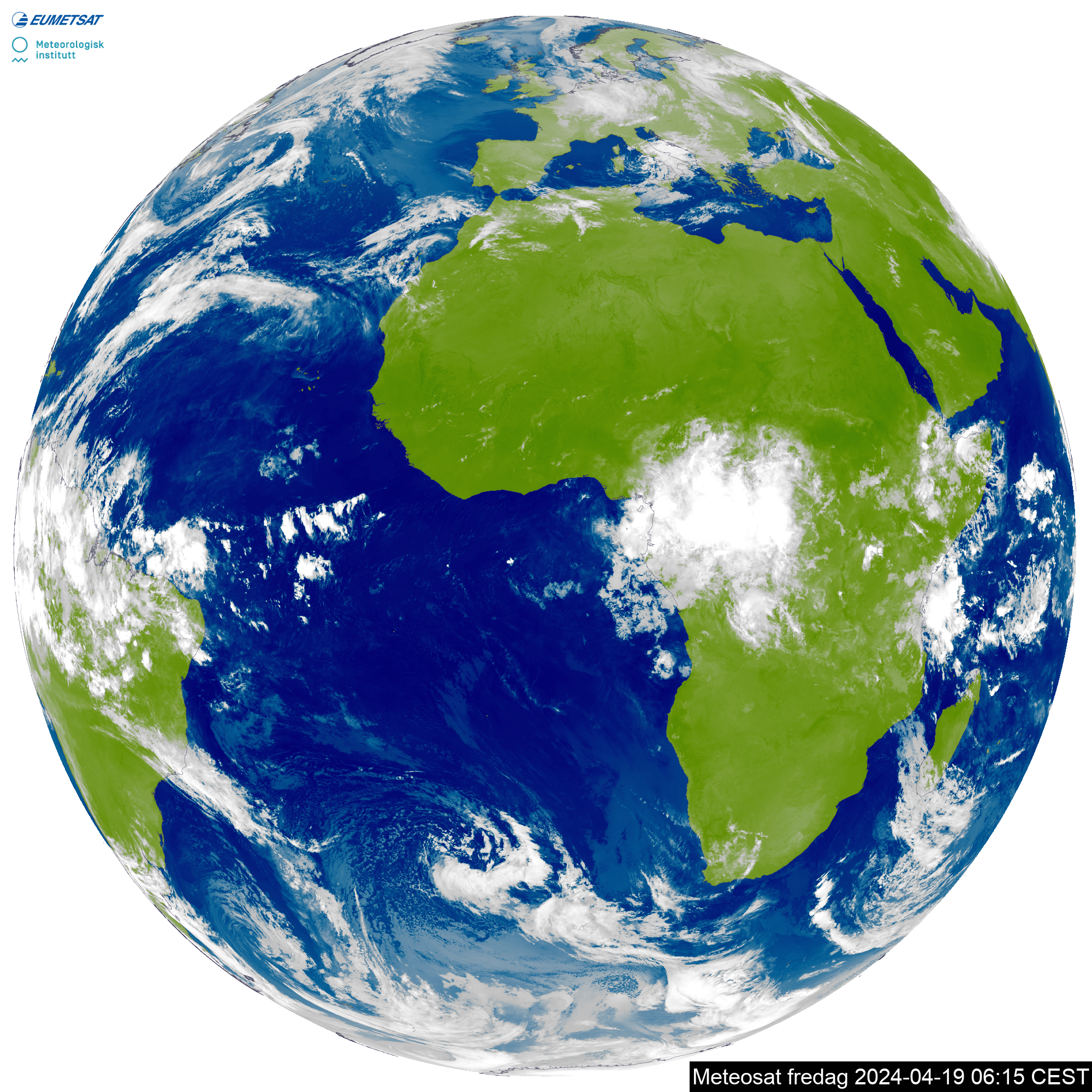
Geosatellite - Images from geostationary satellites
DESCRIPTION
This service delivers images captured by geostationary satellites, in the visible and infrared spectra. New images are produced at least every hour, in some cases every 10 minutes.
Images are provided for a specified area and specified time. If no time is given, the latest available image will be returned.
Restrictions
The data are considered free and unrestricted, according to section 4 of the EUMETSAT Data Policy which states that:
4 "ESSENTIAL" METEOSAT DATA AND PRODUCTS
EUMETSAT shall make its Hourly Meteosat Data, all Derived Products and Advance Image Products available to all users world-wide on a free and unrestricted basis, regardless of when and how these are made available to the user, as "Essential" Data and Products in accordance with WMO Resolution 40 (Cg-XII).
USAGE
Parameters
All parameters are optional
area
Area covered by the satellite image, defaults to "europe". This can also be specified in the URL endpoint
Values: africa, atlantic_ocean, europe, global, mediterranean
type
Type of light spectrum captured in the image. Default is "infrared"
Values: infrared, visible
time
The time the image was captured. If parameter is omitted, the latest available image will be returned.
Format: yyyy-mm-ddThh:mm:00Z (UTC).
This parameter is only allowed for static images
size
Size of image. All images except global and atlantic_ocean have a thumbnail-size image (174x174px) in addition to the full size image. If parameter is omitted, normal is chosen.
Values: normal, small
This parameter is only allowed for static images.
Note: The small size images will be removed on 2026-03-01.
Example requests
https://api.met.no/weatherapi/geosatellite/1.4/?area=europe&type=visible&size=smallhttps://api.met.no/weatherapi/geosatellite/1.4/?area=global&type=infraredhttps://api.met.no/weatherapi/geosatellite/1.4/africa.pnghttps://api.met.no/weatherapi/geosatellite/1.4/europe.mp4
Available
Generate a list of static images, optionally filtered by area, type and/or size. As the full list has over 2000 entries it is very large and slow to generate. We suggest using filter parameters and splitting the list into several downloads to avoid timeouts.
The list only includes PNG files, not video files.
Example requests
https://api.met.no/weatherapi/geosatellite/1.4/availablehttps://api.met.no/weatherapi/geosatellite/1.4/available.json?area=africa
Change Log
Removal of size=small, 2026-01-12
The small size images will be removed on 2026-03-01 due to little use.
At the same time,
the update frequency of the infrared images for the global and atlantic_ocean areas will be increased from hourly to every 10 minutes.
Added video files for Europe, 2021-02-18
Europe area animations in MP4 and WebM formats have been added. URL format has been made more flexible, using area and format as endpoint.
Usage restrictions lifted, 2020-10-01
Satellite images no longer avaiable to public, 2018-06-29
- Due to licensing issues and problems with authentication, delivery of all non-restricted products is temporarily suspended.
- Please follow our mailing list for further announcements.
Extend lifetime of version 1.3, 2016-06-01
Version 1.4, 2016-02-02
- New version, width and height are removed, replaced with size
- areas america, gulf_of_mexico, spain and east_mediterranean are removed
- Version 1.3 is available until 2016-06-06
Version 1.3, 2008-05-28
- height and width as required parameters.
- parameter size has been removed.
- Version 1.2 will expire 2008-07-10.