NAME
Offshoremaps - Lightning and wave maps for offshore helicopter pilots
DESCRIPTION
This service delivers various lightning and wave height maps in PNG format for several areas in Norway, aimed at helicopter traffic in the North Sea. These are primarily intended for use at IPPC.no.
DATA OUTPUT
There are currently three types of maps:
helicopterlightningobservations
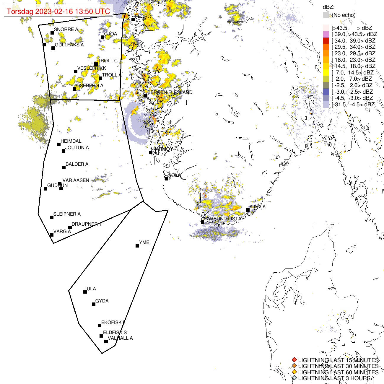 Maps of observed lightning and radar reflectivity.
New images are added every ten minutes, subsequent ones overwriting the first for the same hour. Previous images are available for 6 hours before being removed from the available list.
helicoptertriggeredlightningindex
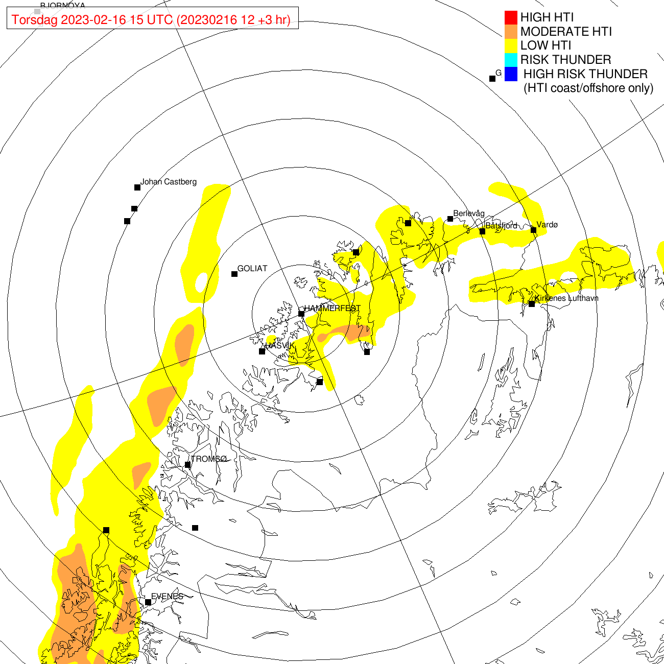 Maps showing risk of helicopter triggered lightning in offshore and coastal regions.
New images are generated every 3 hours for 0-18 hours ahead, replacing previous images for the same time period. Expired images are available for 3 hours backwards.
helicoptersignificantwaveheight
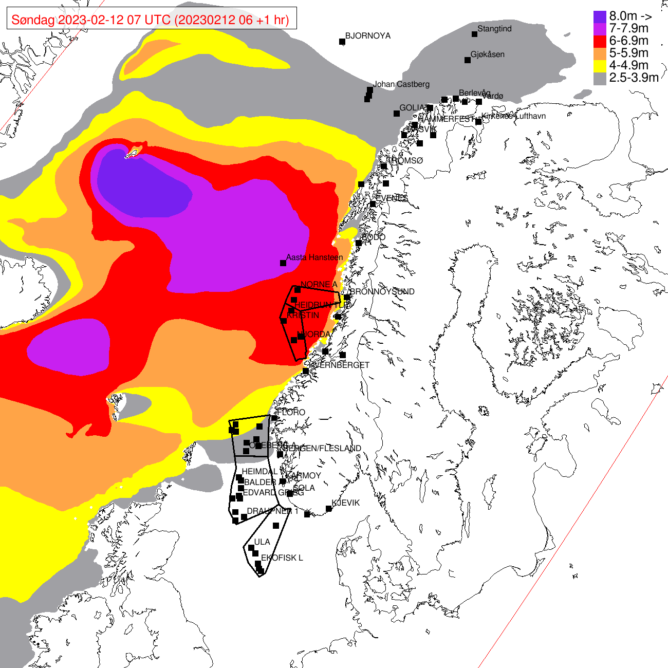 Maps of helicopter-relevant significant wave heights.
New images are generated every 6 hours for 0-18 hours ahead, replacing previous images for the same time period. Expired images are available for 3 hours backwards.
USAGE
Parameters
- type
-
Type of map. Must be used either as parameter or as endpoint (method). Valid types are:
helicopterlightningobservations, helicoptersignificantwaveheight, helicoptertriggeredlightningindex - area
-
The geographical area covered by the map. Valid areas are:
central_norway, northern_norway, norway, western_norway - time (optional)
-
Time of forecast in ISO format, e.g.
2019-01-15T12:00:00Z.If not specified, the earliest available forecast or latest observation is used.
Example requests
https://api.met.no/weatherapi/offshoremaps/1.0/helicopterlightningobservations?area=northern_norway
available
A list of available data may be retrieved using the 'available' method, either as XML or JSON. The list may be filtered by type and/or area.
https://api.met.no/weatherapi/offshoremaps/1.0/available
https://api.met.no/weatherapi/offshoremaps/1.0/available.json?type=helicoptertriggeredlightningindex
Use the updated field in the JSON list to check if a file have been updated.
CHANGELOG
Version 1.0 in production, 2023-06-08
Moved to production
Version 1.0 beta, 2023-02-24
Initial beta version